

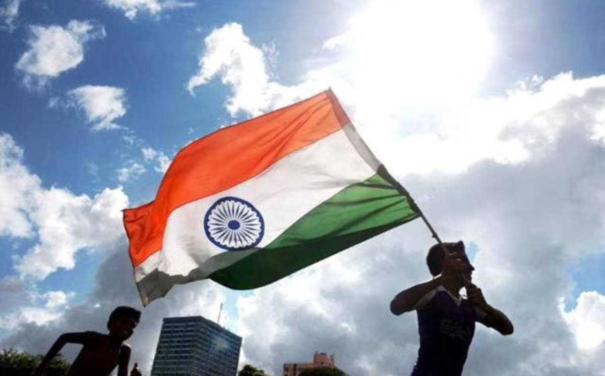
On August 14 and 15, 1947, as India and Pakistan celebrated their independence, uncertainty still hung over several parts of Bengal. In towns such as Krishnanagar in Nadia, English Bazar in Malda and Balurghat in the erstwhile Dinajpur district, Pakistan flags were raised amid widespread speculation that these areas would become part of East Pakistan.
The reason was simple: the Bengal boundary had not yet been officially made public.
Stay Connected · Headline8
Get breaking news instantly — follow our official channels
For nearly three days after Independence, large parts of Murshidabad, Nadia, Malda, the old Dinajpur district and the Bongaon subdivision of Jessore remained in a state of uncertainty. The situation changed only on the evening of August 17, when the details of the Radcliffe Award were broadcast on All India Radio. The announcement revealed that several areas widely expected to fall within Pakistan had instead been assigned to India.
The following day, August 18, the Pakistani flags came down and the Indian tricolour was hoisted in several towns and villages. For these communities, Independence arrived three days late.
That is why August 18 continues to be remembered in parts of Bengal as Bharat Bhukti Dibas, or the Day of Inclusion. In Shibnibas in Nadia, the occasion is marked with flag-hoisting ceremonies and traditional boat races on the Churni River. Balurghat, now the headquarters of South Dinajpur, also observes the date as a parallel Independence Day.
Historian Samit Ghosh told Millennium Post in a 2024 feature that August 18 therefore holds a distinct place in the region’s history.
The Radcliffe ‘Error’ That Was More About Delay
The popular version of the story often portrays Sir Cyril Radcliffe as having initially drawn an incorrect boundary before Lord Louis Mountbatten intervened and ordered changes to the map.
According to this account, Radcliffe’s first division allegedly placed several Hindu-majority areas in East Pakistan, prompting urgent appeals to Mountbatten. The boundary was supposedly altered before its final announcement on August 17, allowing these territories to become part of India.
Historical records, however, point to a different explanation.
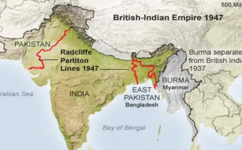
Radcliffe, a British lawyer with no previous experience of India, had been given only around five weeks to divide Bengal and Punjab between the two newly created dominions. He signed his report on the partition of Bengal on August 12, 1947. Mountbatten already had access to the boundary details before India and Pakistan celebrated independence.
The crucial point was that the award was not immediately made public.
The boundary details were officially published only on August 17 in The Gazette of India Extraordinary. The delay was deliberate rather than the result of a last-minute redrawing of the map.
A 2022 essay by the Centre for Law and Policy Research’s Constitution of India project, based on Mountbatten’s “Top Secret and Personal” reports to the British government and the King, records that the Viceroy had been advised not to disclose the boundary before Independence Day.
The concern was that announcing the division in advance could disrupt the independence ceremonies in Karachi on August 14 and Delhi on August 15, while potentially worsening the communal violence already raging, particularly in Punjab.
Mountbatten accepted the advice and kept the boundary details confidential.
What Radcliffe Actually Decided
Research by Cambridge historian Joya Chatterji has also challenged the idea that Mountbatten simply instructed Radcliffe to redraw the Bengal boundary after Independence.
In her 1999 study, The Fashioning of a Frontier: The Radcliffe Line and Bengal’s Border Landscape, 1947–52, Chatterji examined the arguments placed before the Boundary Commission. Among the considerations was the importance of retaining the Hooghly River system and ensuring the economic viability of the river and port network, factors that influenced the case for keeping Murshidabad and much of the Nadia river system within India.
Neither Chatterji’s research nor the published correspondence from the Transfer of Power records indicates that Mountbatten ordered Radcliffe to redraw Bengal’s boundary between August 14 and August 17.
Three Days of Uncertainty
The decision to keep the boundary secret created a vacuum that was quickly filled by rumours and speculation.
In Krishnanagar, English Bazar and Ranaghat, Muslim League workers raised Pakistan flags on August 14 or 15, expecting the areas to become part of Pakistan. Their expectation was not entirely without basis. Murshidabad had a Muslim-majority population, while parts of Nadia and Malda also had significant Muslim populations.
For ordinary families, the uncertainty was deeply unsettling. Recollections from Nadia and Malda describe precautions taken in anticipation of possible communal violence, including nighttime blackouts and, in some households, women temporarily stopping cooking for fear that violence could erupt.
Balurghat witnessed an even more tense confrontation over the flag. According to accounts cited by Ghosh, Gorkha troops and Pathan and Baloch forces clashed in the town between August 15 and August 18. Until the boundary announcement, Balurghat effectively remained a territory whose political future had not been officially settled.
The Tricolour Finally Goes Up
When the Radcliffe Award was finally made public, the map brought several unexpected outcomes.
The whole of Murshidabad was assigned to India, along with most of Nadia. Only three Muslim-majority subdivisions of Nadia — Meherpur, Chuadanga and Kushtia — went to East Pakistan.
Malda, Dinajpur and Jalpaiguri were divided between the two countries, while the Bongaon subdivision of Jessore became part of the then-undivided 24 Parganas district in India.
The decision also produced outcomes on the other side that surprised many. Khulna, despite having a narrow Hindu majority, went to Pakistan, along with portions of Jessore that Hindu petitioners had sought to retain within India.
The Asiatic Society of Bangladesh has noted that Radcliffe’s boundary faced objections from both sides, highlighting how contested and consequential the final settlement was.
For the people of the Bengal districts that raised the Indian flag on August 18, however, the significance of the day was more immediate and personal. It was the moment the uncertainty finally ended.
They had already witnessed the celebrations of independence. But only on August 18 did many of them discover which country they were actually living in.
That delayed revelation transformed August 18 into a day of remembrance — not a second Independence Day in the constitutional sense, but a local commemoration of the moment when their towns and villages were formally included in India.
(Inputs from Hindustan Times)